Project Summary
Full Summary
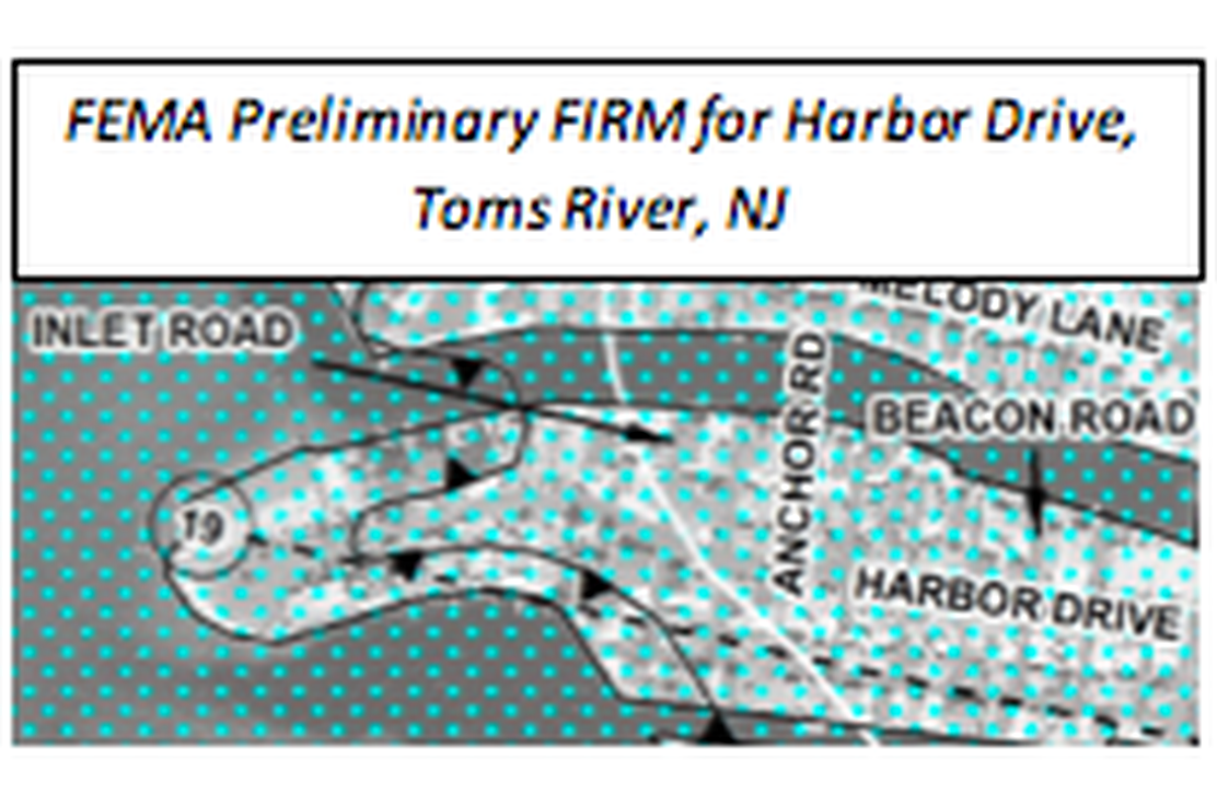
The Township of Toms River, New Jersey retained Najarian Associates to appeal FEMA’s Preliminary Flood Insurance Rate Maps (FIRM) in the Harbor Drive area, a bayside, barrier island neighborhood.
County: Ocean
Town: Toms River
The Township of Toms River, New Jersey retained Najarian Associates to appeal FEMA’s Preliminary Flood Insurance Rate Maps (FIRM) in the Harbor Drive area, a bayside, barrier island neighborhood.
Many homes in the Preliminary FIRMs were classified in the VE-(wave-action) Zone, as compared to the community in the surrounding waterfront, which was primarily placed within an AE-Zone. Based on FEMA directives, the VE-Zone classification had potential for appeal through updated local topographic data or by administering an overland wave-model (WHAFIS) analysis, as well as a new site transect.
Accordingly, Najarian Associates acquired new more accurate, field-survey data, as compared to FEMA’s current, remotely-sensed LIDAR data. This survey included various wave-attenuating features, such as bulkheads, retaining walls, buildings, vegetation, etc. Using the updated modeling, Najarian Associates developed a new WHAFIS model analysis for a new transect along Harbor Drive.
WHAFIS Analysis Results
Modeling results indicated that inclusion of the more accurately surveyed bulkhead elevations reduced simulated wave heights below three feet in the neighborhood. This analysis provided a technical basis for appealing the local VE-Zone delineation. FEMA accepted the appeal, and the Harbor Drive homes were removed from the mapped VE-(wave-action) Zone.
Technical Services
Najarian Associates provided additional services to help the Township plan for the Army Corps’ proposed replenishment of their ocean beach and dune system. The firm employed FEMA’s CHAMP model interface to simulate anticipated wave run-up elevations, wave heights, and dune erosion under the extreme conditions of a 1%-chance coastal storm event.
With this information the Township is able to assess future flood risk in their oceanfront community and plan for any necessary map revisions.