
Project Summary
Full Summary
Najarian Associates’ team of coastal scientists/engineers, surveyors and certified floodplain managers provides specialized FEMA mapping-partner services.
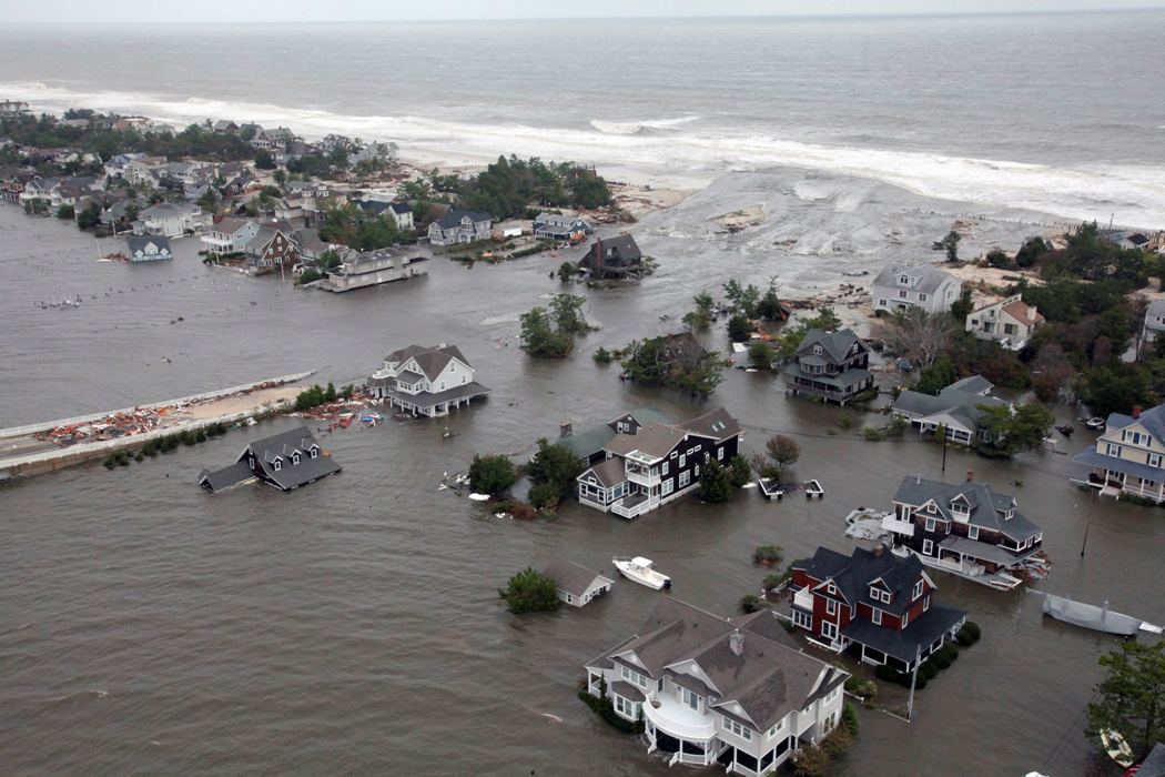
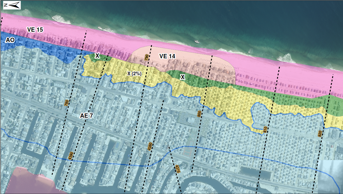
Najarian Associates’ team of coastal scientists/engineers, surveyors, and certified floodplain managers provides specialized FEMA mapping-partner services. To help municipalities address potential Flood Map discrepancies, this expert team reviews FEMA’s Flood Insurance Study (FIS) analyses and, where appropriate, conducts alternative storm-surge model or wave-model analyses following FEMA guidelines and specifications. Also, the team collects new field survey data, which is more accurate than the remotely-sensed (LIDAR) data that FEMA uses to create such maps.
With this combined approach, the team successfully appealed FEMA’s Revised Preliminary Flood Insurance Rate Maps (PFIRMs) for Toms River, West New York, Woodbridge, and Fair Haven – with the mapped Base Flood Elevations (BFE’s) and flood-zone boundaries revised as indicated by the team’s analyses.
Technical Services
- FEMA Elevation Certificate surveys
- Letter of Map Amendment (LOMA) services (for individual property owners who were incorrectly mapped into the mapped Special Flood Hazard Area)
- Letter of Map Revision-Fill (LOMR-F) (for property owners who place fill on their site prior to development)
- FEMA-certified Community Rating System (CRS) program implementation
- WHAFIS overland wave model analysis
- CHAMP dune removal analysis and wave runup analysis
- Extreme value statistical analysis of long-term tide data (to develop alternative 100-year Stillwater elevations)
- Flood hazard mitigation and coastal resiliency planning